Online or onsite, instructor-led live QGIS training courses demonstrate through interactive hands-on practice how to use QGIS to analyze, visualize, and manage geospatial data effectively.
QGIS training is available as "online live training" or "onsite live training". Online live training (aka "remote live training") is carried out by way of an interactive, remote desktop. Onsite live QGIS training can be carried out locally on customer premises in Graz or in NobleProg corporate training centers in Graz.
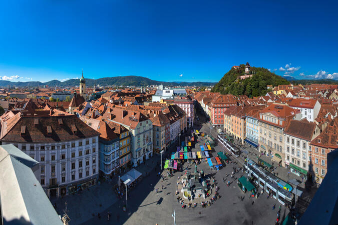
NobleProg -- Your Local Training Provider
NobleProg Graz
Waagner-Biro-Strasse 47, Graz, Austria, 8020
Overview
Our training facilities are located at Waagner-Biro-Strasse 47 in Graz. Our spacious training rooms are located directly in the old town and offer optimal training conditions for your needs.
Directions
The NobleProg training facilities are best reached via the A9 motorway and the federal highway 67.
Parking spaces
There are parking spaces in the streets around our training rooms as well as the ContiPark multi-storey car park.
Local infrastructure
There are numerous restaurants in the downtown area and hotels are also within walking distance.
This instructor-led, live training in Graz (online or onsite) is aimed at beginner-level earth sciences and engineering professionals who wish to use Python for geospatial analysis in both ArcGIS and QGIS environments.
By the end of this training, participants will be able to:
Learn Python syntax and control structures for executing geospatial tasks efficiently.
Use Pandas, Numpy, and Matplotlib for data analysis and visualization in GIS.
Manipulate and analyze vector data with Geopandas, Arcpy, and PyQGIS libraries.
Automate geospatial processes and workflows using Python scripting in ArcGIS and QGIS.
Develop custom Python-based geoprocessing tools for ArcGIS and QGIS to streamline tasks.
A geographic information system (GIS) is a system designed to capture, store, manipulate, analyze, manage, and present spatial or geographic data. The acronym GIS is sometimes used for geographic information science (GIScience) to refer to the academic discipline that studies geographic information systems and is a large domain within the broader academic discipline of geoinformatics.
QGIS functions as geographic information system (GIS) software, allowing users to analyze and edit spatial information, in addition to composing and exporting graphical maps. QGIS supports both raster and vector layers; vector data is stored as either point, line, or polygon features. Multiple formats of raster images are supported, and the software can georeference images. To summarize it allows the users to Create, edit, visualise, analyse and publish geospatial information on Windows, Mac, Linux, BSD.
This program, in its first phase, introduces the QGIS interface for general usage. In the second phase, we introduce PyQGIS - the python libraries of QGIS that allows the integration of GIS functionalities in your python code or your python application, so that you may even create your own Python Plugin around a particular GIS functionality.
Online QGIS training in Graz, QGIS training courses in Graz, Weekend QGIS courses in Graz, Evening QGIS training in Graz, QGIS instructor-led in Graz, Weekend QGIS training in Graz, Evening QGIS courses in Graz, QGIS trainer in Graz, Online QGIS training in Graz, QGIS classes in Graz, QGIS coaching in Graz, QGIS boot camp in Graz, QGIS one on one training in Graz, QGIS on-site in Graz, QGIS instructor-led in Graz, QGIS instructor in Graz, QGIS private courses in Graz